
Furnace Repair Service Areas — Colorado Springs & Surrounding Communities
We provide altitude-calibrated furnace repair, installation, and maintenance across Colorado Springs and 13+ surrounding communities. Every area we serve sits at a different elevation — from 5,800 feet in Fountain to over 8,400 feet in Woodland Park — and we adjust our service approach accordingly.
Every Community We Serve Has a Different Altitude — And That Changes Everything
Most homeowners do not realize that a furnace installed in Fountain at 5,810 feet requires different calibration than a furnace installed in Woodland Park at 8,437 feet. The difference in atmospheric pressure between these two communities is significant enough to change gas orifice requirements, manifold pressure settings, and BTU derating calculations.
According to ANSI Z21.47, gas appliances must be derated by approximately 4% per 1,000 feet of elevation above sea level. For a furnace rated at 100,000 BTU at sea level, this means:
- Fountain (5,810 ft) — derated to ~76,760 BTU (23.2% reduction)
- Colorado Springs (6,035 ft) — derated to ~75,860 BTU (24.1% reduction)
- Monument (6,976 ft) — derated to ~72,096 BTU (27.9% reduction)
- Woodland Park (8,437 ft) — derated to ~66,252 BTU (33.7% reduction)
A technician who uses the same calibration settings in Fountain and Woodland Park is making an error that directly impacts combustion efficiency, carbon monoxide production, and heat exchanger longevity. Our technicians carry altitude-specific reference charts and adjust every installation and repair to match the exact elevation of your property — not just the general area.
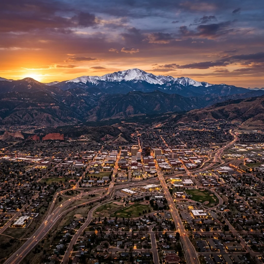
Colorado Springs Neighborhoods We Serve
Our primary service area covers every neighborhood within Colorado Springs city limits. From the historic homes in Old Colorado City to the modern developments in Briargate and Powers Corridor, we know the heating challenges specific to each area.
Colorado Springs sits at a base elevation of 6,035 feet, but elevation varies significantly across the city. Properties on the west side near Garden of the Gods and Manitou Springs tend to sit at higher elevations (6,200–6,500 feet), while the southeast areas near the airport and Powers Corridor are closer to 6,000 feet. The north end of the city — Briargate, Northgate, and Flying Horse — gradually climbs toward the 6,400-foot range. These differences matter when calibrating furnace equipment, and our technicians account for them on every service call.
Cities & Communities Beyond Colorado Springs
Our service territory extends 30–50 miles from our base at 1342 Bates Dr, covering communities across El Paso County, Teller County, and parts of Douglas County. Each community page includes elevation-specific heating information and local service details.
Manitou Springs
Elevation: 6,320 ft — A historic mountain town at the base of Pikes Peak. Many older homes with aging furnaces that require altitude-specific maintenance. Known for significant temperature swings between day and night during winter months.
View Manitou Springs service details →Fountain
Elevation: 5,810 ft — Located south of Colorado Springs along I-25. One of our lower-elevation service areas, with growing residential development. Furnaces here require less derating than higher-altitude communities but still need altitude orifice kits.
View Fountain service details →Monument
Elevation: 6,976 ft — A rapidly growing community north of Colorado Springs along I-25. Nearly 1,000 feet higher than Colorado Springs, Monument properties require more aggressive BTU derating (27.9%) and specialized high-altitude configurations.
View Monument service details →Security-Widefield
Elevation: 5,850 ft — A census-designated community south of Colorado Springs near Fort Carson. Mix of military families and long-term residents. Predominantly mid-efficiency furnaces in homes built during the 1970s–1990s expansion period.
View Security-Widefield details →Black Forest
Elevation: 7,100 ft — A rural, heavily forested community northeast of Colorado Springs. Properties here sit over 1,000 feet above the city, requiring 28.4% BTU derating. Many homes use propane rather than natural gas, which adds another variable to furnace calibration.
View Black Forest service details →Cimarron Hills
Elevation: 6,100 ft — A census-designated place on the eastern edge of Colorado Springs. Primarily residential with a mix of single-family homes and apartment complexes. Easy access from our base location for fast response times on emergency calls.
View Cimarron Hills details →Woodland Park
Elevation: 8,437 ft — Our highest-elevation service area. Located west of Colorado Springs in Teller County, Woodland Park requires the most aggressive altitude calibration in our service territory — 33.7% BTU derating. Winters here are longer, colder, and heating systems work harder than anywhere else we serve.
View Woodland Park details →Gleneagle
Elevation: 6,890 ft — An unincorporated community north of Colorado Springs near the Air Force Academy. Gleneagle features newer construction with modern high-efficiency furnaces. At nearly 7,000 feet, proper altitude configuration is critical for both safety and efficiency.
View Gleneagle service details →Woodmoor
Elevation: 7,150 ft — A planned community in unincorporated El Paso County near Monument. Woodmoor's elevation is over 1,100 feet above Colorado Springs, meaning furnaces here face more extreme altitude conditions. We service both the older original homes and newer construction throughout the community.
View Woodmoor service details →Cascade-Chipita Park
Elevation: 7,400 ft — Mountain communities along the Ute Pass corridor west of Colorado Springs. Remote locations and steep terrain can make emergency response challenging during winter storms. We prioritize these areas for same-day service and carry extra parts for common mountain-property heating issues.
View Cascade-Chipita Park details →Stratmoor
Elevation: 5,920 ft — An unincorporated community adjacent to Fort Carson on the south side of Colorado Springs. Stratmoor features a mix of established residential neighborhoods with furnaces ranging from 10 to 30+ years old. Proximity to our base means fast emergency response times.
View Stratmoor service details →Fort Carson & Air Force Academy
We proudly serve military families and personnel living on and around Colorado Springs' two major military installations.
Fort Carson
Elevation: 5,840 ft — Home to the 4th Infantry Division and one of the largest military installations in the western United States. We service military family housing in the surrounding communities, including on-post housing managed by private contractors. Military families frequently relocate from lower elevations and inherit furnaces that may not be properly calibrated for Colorado's altitude.
View Fort Carson service details →Air Force Academy
Elevation: 6,780 ft — The United States Air Force Academy sits at the north end of Colorado Springs. Residential areas surrounding the Academy — including Pine Valley, Douglass Valley, and the housing developments along North Gate Boulevard — sit at elevations between 6,500 and 7,000 feet. We service both military and civilian housing throughout this area.
View Air Force Academy details →Service Area Elevation & BTU Derating Guide
This table shows the elevation, required BTU derating percentage, and approximate distance from our office for each community we serve.
| Community | Elevation | BTU Derating | Distance from Office | Emergency Response |
|---|---|---|---|---|
| Colorado Springs | 6,035 ft | 24.1% | Base location | Under 60 min |
| Manitou Springs | 6,320 ft | 25.3% | ~8 miles | Under 75 min |
| Fountain | 5,810 ft | 23.2% | ~12 miles | Under 75 min |
| Monument | 6,976 ft | 27.9% | ~18 miles | Under 90 min |
| Security-Widefield | 5,850 ft | 23.4% | ~10 miles | Under 75 min |
| Black Forest | 7,100 ft | 28.4% | ~15 miles | Under 90 min |
| Cimarron Hills | 6,100 ft | 24.4% | ~5 miles | Under 60 min |
| Woodland Park | 8,437 ft | 33.7% | ~25 miles | Under 120 min |
| Gleneagle | 6,890 ft | 27.6% | ~16 miles | Under 90 min |
| Woodmoor | 7,150 ft | 28.6% | ~20 miles | Under 90 min |
| Cascade-Chipita Park | 7,400 ft | 29.6% | ~18 miles | Under 90 min |
| Stratmoor | 5,920 ft | 23.7% | ~6 miles | Under 60 min |
| Fort Carson | 5,840 ft | 23.4% | ~10 miles | Under 75 min |
| Air Force Academy | 6,780 ft | 27.1% | ~14 miles | Under 90 min |
Call Us — We May Still Be Able to Help
Service Area FAQs
Direct Answer: We cover a 30 to 50-mile radius from our base at 1342 Bates Dr, servicing all of El Paso County, Teller County, and southern Douglas County communities.
Direct Answer: No. We offer flat-rate pricing with zero travel surcharges across all listed regional service areas, crediting $99 diagnostic fees 100% toward repairs.
Direct Answer: Higher elevations reduce air density and available oxygen. Furnaces must be derated by 4% per 1,000 ft above sea level (24% to 34% derate) to prevent carbon monoxide.
Direct Answer: Yes. We maintain 24/7 priority emergency dispatch across all communities, with arrival times ranging from 30 to 90 minutes depending on mountain travel.
Direct Answer: We perform digital combustion analysis measuring CO, O2, stack temp, and gas manifold pressure. Yellow flames, soot, or delayed ignition indicate improper altitude calibration.
Direct Answer: Yes. Propane units in Black Forest, Divide, or Woodland Park require dedicated LP conversion kits combined with high-altitude orifice derating to 11.0" w.c. pressure.
Direct Answer: Yes. Extended heating seasons and low air density increase annual runtime hours, reducing average furnace lifespans to 12–16 years compared to 15–20 years at sea level.
Direct Answer: Yes, but burner orifice sizes and gas manifold pressures differ significantly (23.2% derate for Fountain vs 33.7% derate for Woodland Park).
Direct Answer: Homeowners qualify for up to $2,000 in Federal IRA tax credits for heat pump hybrids, up to $600 for 97%+ AFUE furnaces, and local CSU, Xcel, and Black Hills rebates.
Direct Answer: Call +1 (719) 602-8787. We regularly accommodate surrounding rural communities and mountain properties throughout the Pikes Peak region.
Altitude-Calibrated Furnace Service for Every Elevation in the Pikes Peak Region
Whether you are at 5,800 feet or 8,400 feet, we calibrate every repair and installation to your exact elevation. Call us any time — 24 hours a day, 7 days a week.